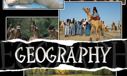
For 2nd Grade Geography, I wanted to get my son to know a little bit more about the world – different continents, countries, languages spoken in those countries, what the people look like, religions, native animals etc.
So I created a Travel Notebook that consisted of travel sheets for the countries I selected us to study. I used the Everything Kids Geography Book as guideline to read about different places in the world on which I could do some research, and to give us information in a nutshell about the most important aspects of a country.
We also used the Usborne Geography Encyclopedia that has a lot of good photographs and maps for the countries we studied.
The Travel Sheets I created included:
- an “Entrance Date Stamp” field, where I let him stamp the date of the day we started studying a specific country
- two outline maps: one of the continent containing the country we’re studying, and a world map. I let him color the country on the continent map, and then let him find and color where it is on the world map as well
- a compass indicating the borders of the country – Using the atlas in the Usborne Geography Encyclopedia, I let him find and specify the respective borders (countries and/or oceans)
- a distance field, where he could write how many kilometers it is from where we are (or the closest airport) to the capital city of the country we’re studying (http://www.travelmath.com proved helpful!)
- a time field, where he could record how long it would take to get there by airplane (http://www.travelmath.com again!)
- two empty clock faces – one to draw the current time (here and now), and one to draw the time of the country we’re studying – I let him use our wall world map to determine the time zone and then work out the time difference between the two countries and ultimately the time in that country
- a GMT space to record the Greenwich Mean Time difference
- a capital city “stamp” space, where he could paste a sticker or logo of the name of the capital city, also stamped with a date stamp to mark our “entrance” to the city (when we started reading up on it)
- a country population space
- a clear block where he could paste “collectables from places visited” (I searched online for logos, scanned stamp images and clipart that could all tell about the places we “visited” (read about), that he could cut and paste in this space)
- four fields/spaces to record different languages spoken in the country we studied
- space to record phrases in one of the native languages (Google Translate did an acceptable job for this purpose)
- space to record the most dominant religion in the country
- space to record the currency of the country
- a clear block to paste a picture of the country’s national animal
- an outline flag of the country for him to color
- space to record interesting and/or amazing facts he remembered about the country (he was not yet writing a lot, so I let him narrate and recorded it for him)
- space to record traditional celebrations of the country
- an “Exit Date Stamp” space that he could stamp with the date we finished the country and moved on to the next
The idea was for it to work sort of like a passport getting stamped, and an album collecting all the memorabilia of traveling.
I collected photos online of the country’s leader (president/king/queen), people (traditional), capital city, landmarks, animals, mountain ranges, transport, money used, etc. so that everything was not just hypothetical, but that he could get a real feeling of what it looked like over there (Unfortunately because of the copyright on photos, I can’t add the document I created for this purpose here for download).
I also collected background information on important dates, persons, celebrations and places (some of which are mentioned in the Everything Kids Geography Book).
** I guess you could print out a scanned image of a country’s paper money (found online) and paste the insides together and let your child add that to the notebook too… they usually find it interesting to see what it really looks like!
Then, I collected recipes of traditional food, which I prepared as we studied the respective countries.
We also listened to the country’s national anthem (I played it while we were getting ready to start the study on the country), and discussed whether we liked it or not, and why (http://en.wikipedia.org/wiki/List_of_national_anthems).
It turned out to be a lot of fun, and I learned just as much as he did!
You can download the individual country Travel Sheets from the links below. Print them out and bind them into a Travel Notebook, and HAVE FUN studying Geography!
Travel Sheets:
Africa
Botswana
Ethiopia
Kenya
Morocco
Nigeria
South Africa
Tanzania
Zambia
Asia
China
India
Indonesia
Japan
Malaysia
North Korea
Philippines
South Korea
Thailand2
Turkey
Australasia
Caribbean
Central America
Europe
Spain
Sweden
United Kingdom
Austria
Cyprus
Estonia
France
Germany
Greece
Italy
Norway
Portugal
Europe (Western)
Czech Republic
Moldova
Romania
Poland2
Ukraine
Middle East
Sudan
Turkey
Yemen
Egypt
Iran
Iraq
Israel
Jordan
Kuwait
Lebanon
Oman
Saudi Arabia
North America
Canada
Mexico
United States of America
South America

